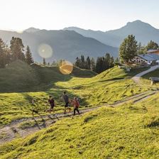
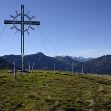
 Huberhöhe Erpfendorf
Ausgangspunkt Erpfendorf - Parking Griesbachklamm P1 or P2
Endpunkt Erpfendorf - Parking Griesbachklamm P1 or P2
LeichtGrassy summit ridge with beautiful panoramic view.
Höhenmeter:
506 m
506 m
Höchster Punkt:
1136 m
1136 m
Streckenlänge:
8,9 km
8,9 km
Zeit:
4:00 h
4:00 h
 Niederkaiser via Maiklsteig and Schleier Waterfall
Ausgangspunkt St. Johann in Tirol - hiking parking lot Rummlerhof
Endpunkt St. Johann in Tirol - hiking parking lot Rummlerhof
LeichtA long an demanding hike that rewards with a refreshing waterfall and superb views of the Wilder Kaiser range.
Höhenmeter:
820 m
820 m
Höchster Punkt:
1370 m
1370 m
Streckenlänge:
12,4 km
12,4 km
Zeit:
6:00 h
6:00 h
 Nature and adventure route - Unterer Grundr Grund
Ausgangspunkt Kneippanlage Aschau
Endpunkt Kneippanlage Aschau
LeichtThe hiking route is very suitable for families, easy to walk and for small children or even with a child’s pushchair is possible without any problems. Lots of resting opportunities with benches and b...
Höhenmeter:
532 m
532 m
Höchster Punkt:
1548 m
1548 m
Streckenlänge:
12,0 km
12,0 km
Zeit:
3:30 h
3:30 h
 Hängebank Schneckgass
Ausgangspunkt Ortszentrum Brixen im Thale
Endpunkt Ortszentrum Brixen im Thale
Leicht
Höhenmeter:
60 m
60 m
Höchster Punkt:
860 m
860 m
Streckenlänge:
2,5 km
2,5 km
Zeit:
0:45 h
0:45 h
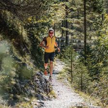 Trailrunning St. Ulrich a.P. Grieseltal Schießlingalm
Ausgangspunkt small car park at hamlet Weißleiten St. Ulrich a.P.
Endpunkt small car park at hamlet Weißleiten St. Ulrich a.P.
Leicht
Höhenmeter:
400 m
400 m
Höchster Punkt:
1280 m
1280 m
Streckenlänge:
8,1 km
8,1 km
 Lechner Wasserfall
Ausgangspunkt Tourist information office Wörgl
Endpunkt Tourist information office Wörgl
Leicht
Höhenmeter:
70 m
70 m
Höchster Punkt:
564 m
564 m
Streckenlänge:
10,3 km
10,3 km
 Winter Hiking Route to the Brixenbachalm
Ausgangspunkt Reiterbrücke im Ortsteil Brixenbach
Endpunkt Reiterbrücke im Ortsteil Brixenbach
LeichtA beautiful, daily-maintained Winter hiking route leading to a quaint managed mountain hut, “Brixenbachalm". www.brixenbachalm.com
Höhenmeter:
200 m
200 m
Höchster Punkt:
1092 m
1092 m
Streckenlänge:
2,0 km
2,0 km
Zeit:
1:15 h
1:15 h
 Bike & Hike Lodron über Lodronalm
Ausgangspunkt Radstartpunkt Wasserfeld
Endpunkt Lodron
Leicht
Höhenmeter:
1305 m
1305 m
Streckenlänge:
16,0 km
16,0 km
Zeit:
3:15 h
3:15 h